Post-Tropical Cyclone Karen 2025
Last Modified:
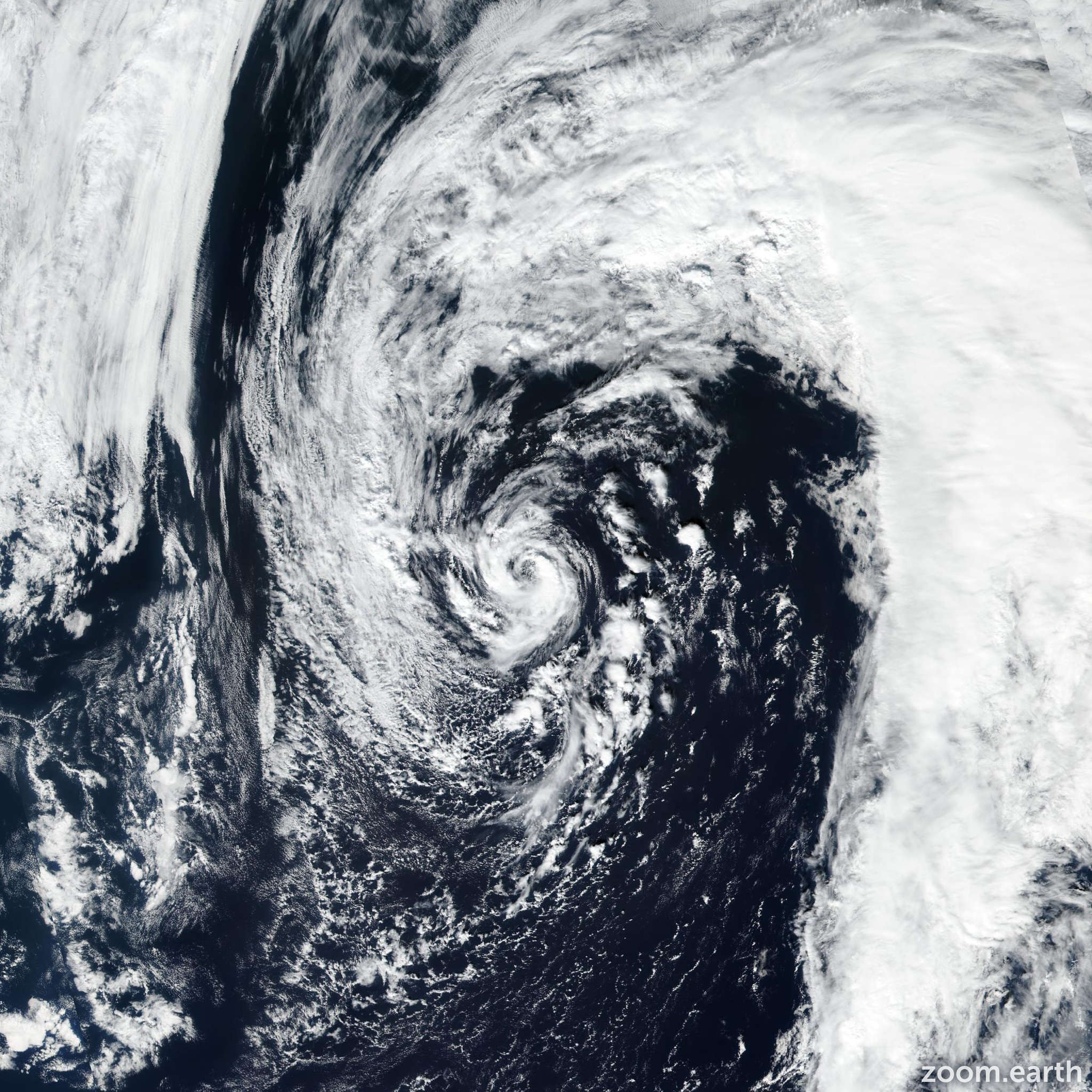
Live tracking map, satellite images and forecasts of Post-Tropical Cyclone Karen 2025 in the North Atlantic Ocean. Current wind speed 35mph. Max 45mph.
Convection associated with Karen has dissipated this evening, leaving the system a swirl of low- to mid-level clouds. The cyclone will be moving over even colder waters of the North Atlantic during the next 12 to 24 hours, and organized convection is not expected to return. Therefore, Karen has lost its designation as a subtropical cyclone, and this will be the last NHC advisory. The initial intensity remains 45 mph (40 knots), based on earlier ASCAT data. The low should gradually weaken during the next 12 to 24 hours, and it is expected to open up into a trough and be absorbed by an approaching frontal system in 24 to 36 hours.
The low is moving north-northeastward or 025 degrees at 15 mph (14 knots). The system should continue to accelerate north-northeastward ahead of an approaching deep-layer trough through Saturday. The updated NHC track forecast is once again similar to the previous forecast and near the center of the guidance envelope.