Tropical Depression 28W 2026
Last Modified:
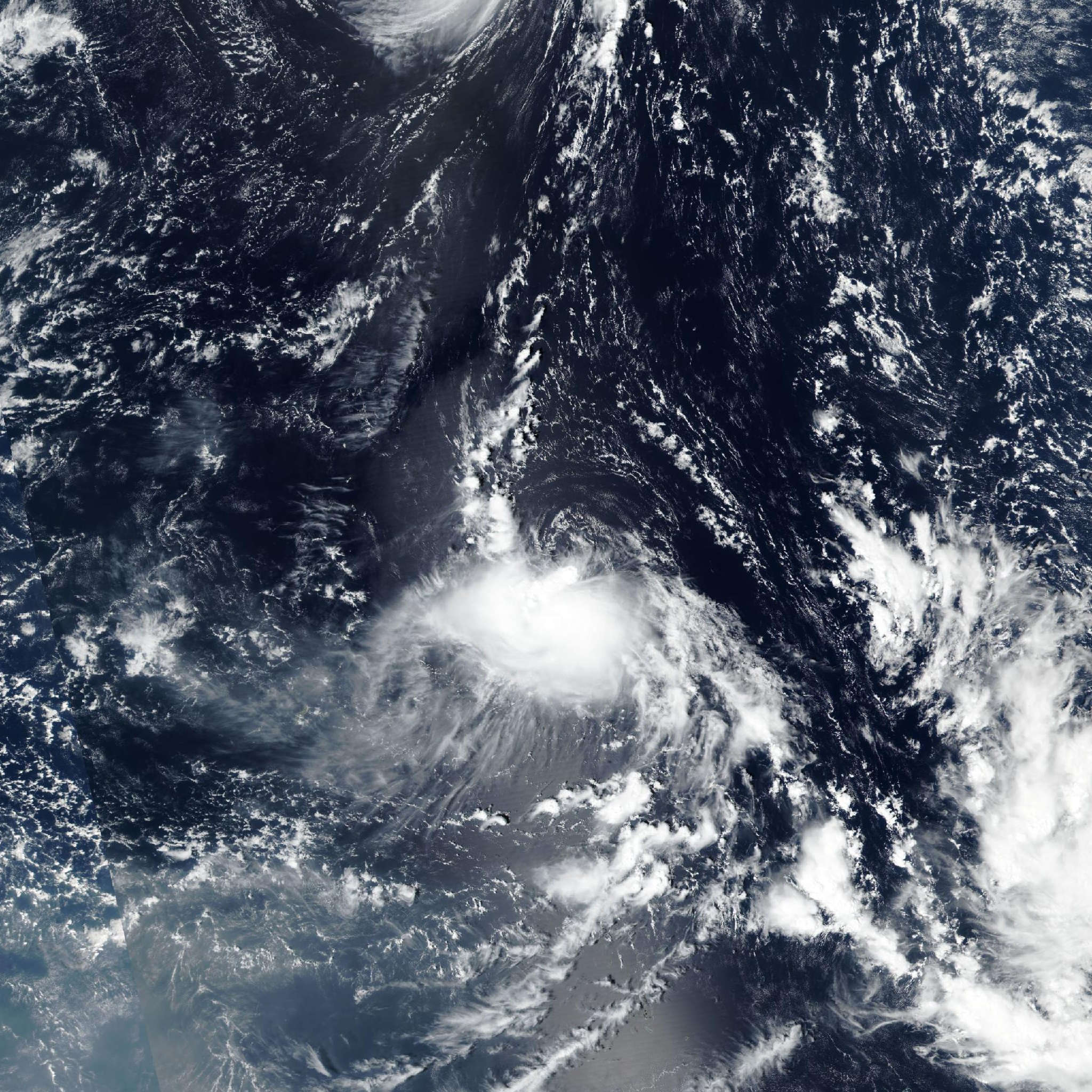
Live tracking map, satellite, radar, and forecasts of Tropical Depression 28W 2026 near the Northern Mariana Islands. Current wind speed 45km/h. Max 55km/h.
28W is located 404 km north of Saipan, and has tracked northwestward at 22 km/h (12 knots) over the past 6 hours. Maximum significant wave height is 3.4 meters (11 feet).
28W is forecast to track northwestward, steered by the lower-level flow along the southwestern flank of a deep-layer subtropical ridge, throughout the forecast period.
Regarding intensity, as the system tracks northwestward, it is expected to remain synoptically coupled with the ULL and inverted trough, resulting in a persistent deficit of divergent outflow aloft despite a low-shear environment.
Overall, the mid-levels to the north and west are projected to remain dry, although some mesoscale models show a modest improvement in the moisture profile in around 24 hours.
Transient convective bursts will continue to flare temporarily within the convergent southeastern quadrant over the next 24 hours; however, such activity will remain unable to persist or organize into convective cores due to the intrusion of the dry mid-level air and the deficit of a stable outflow mechanism aloft.
The lower-level vortex is reasonably well defined; consequently, its dissipation profile will be progressive, with dissipation below warning criteria projected in 36 hours.
Track guidance is in excellent agreement, with all consensus members concurring on a northwestward trajectory through the forecast period. The GFS and GEFS ensemble mean represent the only excursions, drifting slightly poleward of the pack and increasing cross-track spread to 185 km in 36 hours.
The JTWC forecast favors the multi-model consensus mean high confidence. Intensity guidance presents pronounced dispersion, particularly after 24 hours.
The operational and experimental Google DeepMind alongside the GFS show gradual decay and dissipation in 36 hours. Conversely, the HAFS-A, CTCX, and statistical SHIPS-GFS suites show modest intensification over the next 24 hours over the next 5 days.
The SHIPS shows the system attaining 95 km/h (50 knots) in 5 days; however, the dynamical factors resolved by the SHIPS suite show excessive wind shear (>30 knots) and a hostile moisture profile (mid-level rh less than 40%), rendering this run dynamically inconsistent.
Accordingly, the JTWC intensity forecast leans toward the DeepMind and GFS decay profile with high confidence.