Major Hurricane Beryl 2024
Last Modified:
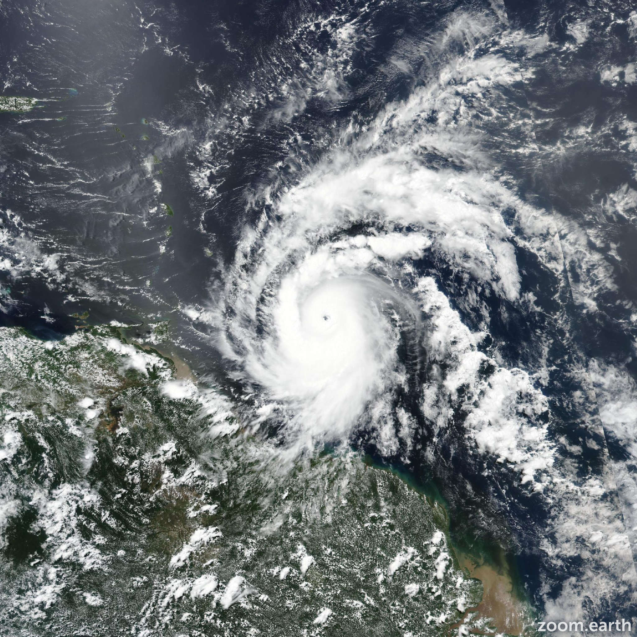
Live tracking map, satellite images and forecasts of Major Hurricane Beryl 2024 near Barbados. Current wind speed 130mph. Max 145mph.
Beryl is expected to remain an extremely dangerous Category 4 hurricane when it reaches the Windward Islands. This is a very dangerous situation and residents in these areas should listen to local government and emergency management officials for any preparedness and/or evacuation orders. All preparations should be rushed to completion today (June 30).
Potentially catastrophic hurricane-force winds, a life-threatening storm surge, and damaging waves are expected when Beryl passes over portions of the Windward Islands with the highest risk of the core in St. Vincent and The Grenadines, and Grenada beginning early Monday morning. Hurricane Warnings are in effect for much of the Windward Islands.
Heavy rainfall and localized flooding are expected across the Windward Islands through Monday.
Beryl is expected to remain a powerful hurricane as it moves across the Caribbean Sea later this week. A Tropical Storm Watch has been issued for portions of the southern coast of the Dominican Republic and Haiti. Interests elsewhere in Hispaniola, Jamaica, the Cayman Islands, and the remainder of the northwestern Caribbean should monitor its progress.
After rapidly strengthening for two days straight, Beryl's intensity appears to have leveled off. The extremely dangerous category 4 hurricane has a circular 10 nautical miles eye with mesovorticies within it. However, the convection in the eyewall has become a little less symmetric over the past few hours as it has eroded a bit on the south side. The initial intensity is held at 130 mph (115 knots), which is near the high end of the latest satellite estimates. Both the NOAA and Air Force Hurricane Hunters are scheduled to investigate Beryl again later this evening.
Beryl continues to move swiftly westward at 20 mph (18 knots) steered by a strong subtropical ridge to its north. A continued relatively quick westward to west-northwestward motion is expected during the next several days as subtropical ridging remains the primary steering feature. Only a minor shift to the north has been made this cycle, following the trend in the latest models.
Fluctuations in strength are common in major hurricanes in conducive environments, and it is expected that Beryl will also fluctuate in strength for the next day or so. There is high confidence that Beryl will remain an extremely dangerous hurricane through landfall in the Windward Islands. As the hurricane tracks across the Caribbean Sea, there likely will be a gradual increase in wind shear, which should induce a slow weakening trend. However, it should be emphasized that Beryl is forecast to remain a significant hurricane during its entire trek across the Caribbean region. The NHC intensity forecast is an update of the previous one and in good agreement with the HCCA and IVCN models.