Tropical Storm Lorena 2025
Last Modified:
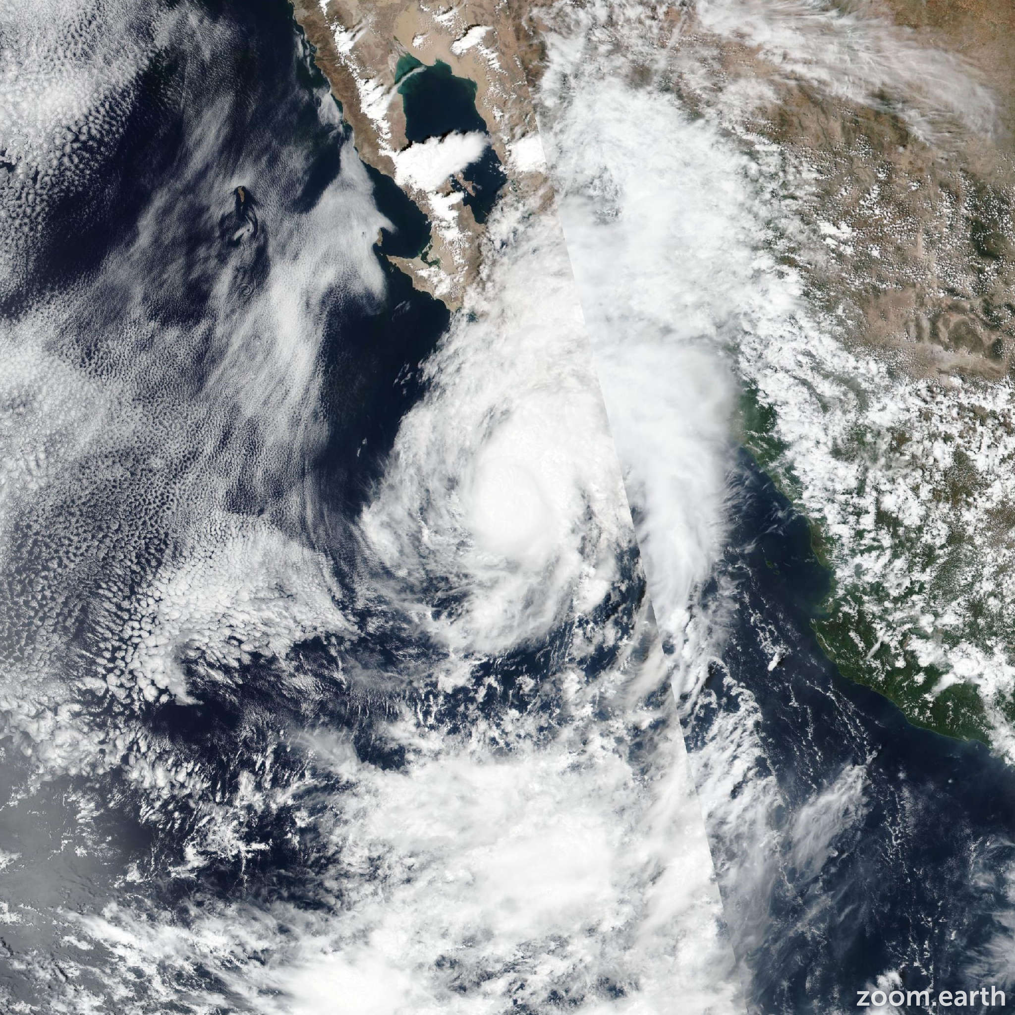
Live tracking map, satellite images and forecasts of Tropical Storm Lorena 2025 west of Baja California Sur, Mexico. Current wind speed 60mph. Max 85mph.
Heavy rainfall associated with Lorena will continue to impact Baja California Sur and Sonora Mexico through Friday. This will increase the risk of life-threatening flash floods and mudslides across northwest Mexico.
Moisture from Lorena will contribute to heavy rainfall concerns across Arizona and New Mexico through Saturday. Isolated to scattered instances of flash flooding are possible across Arizona into Saturday.
The center of Lorena is forecast to move parallel to, but offshore of, the southwest coast of the Baja California Peninsula through tonight, and then could move closer to the west-central coast of the peninsula while it weakens on Friday. Tropical storm conditions, mainly in gusts, are likely along portions of the coast of Baja California Sur today (4 September) through Friday, where a Tropical Storm Warning is in effect.
Life-threatening surf and rip current conditions will affect portions of the southern and western coasts of Baja California Sur during the next couple of days.
Lorena has crossed the 26°C sea-surface temperature isotherm and is now experiencing about 25 mph (20 knots) of southwesterly wind shear. Recent GMI and AMSR-2 microwave passes indicate that the center is now located near or just outside of the convective area, and the convection is beginning to get sheared off toward the northeast. The latest subjective intensity estimates from SAB and TAFB range from 55–77 knots, and the UW-CIMSS objective intensity estimates range from 50–62 knots. The initial intensity is lowered to 70 mph (60 knots) for this advisory, making Lorena a tropical storm. As Lorena continues to slowly gain latitude, it will progressively encounter colder water temperatures and stronger southwesterly shear. The latest NHC intensity forecast shows fairly quick weakening to a remnant low in about 36 hours, in agreement with the guidance. This is a slightly faster rate of weakening compared to the previous official forecast. The remnant low should then dissipate completely in about 3 days, likely offshore, to the west of Baja California.
The GFS model and all of NHC's consensus guidance (including the HCCA, Google DeepMind, and TCVE) have come onboard to the solution that the ECMWF, UKMET, and CMC models have been advertising for the past couple of days, which shows Lorena slowing down and dissipating offshore, to the west of Baja California. The only models that still bring Lorena's center into the Baja California peninsula are the HAFS models and the HMON (as a weak low, below tropical storm strength). As Lorena's convection gets stripped off toward the northeast, its path will soon be governed by the low-level steering currents, which should keep Lorena moving slowly offshore as it weakens. The new NHC forecast represents a large change from the previous forecast, and now keeps the center of Lorena offshore.
Although the chance of sustained tropical-storm-force winds on land is starting to decrease, the rainfall and flash flooding threat for the Baja California peninsula is still significant. Abundant moisture will continue to stream northeastward away from the cyclone. Because of that, there is still a significant risk of heavy rainfall and flash flooding across portions of Baja California Sur, Sonora, southern Arizona and New Mexico.