Tropical Cyclone Maila 2026
Last Modified:
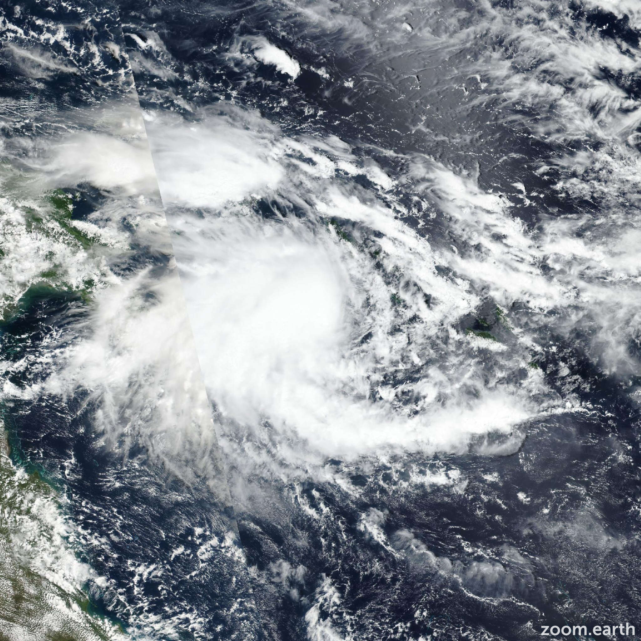
Live tracking map, satellite, radar, and forecasts of Tropical Cyclone Maila 2026 near Papua New Guinea. Current wind speed 120km/h. Max 205km/h.
Maila is located 1280 km northeast of Cairns, Australia, and has tracked west-northwestward at 4 km/h (2 knots) over the past 6 hours. Maximum significant wave height is 7.3 meters (24 feet).
Maila is expected to remain within a competing steering environment, squished between ridging to both the north and south, through the next 4 days.
Throughout this time, erratic track motion is possible, though the forward advance speed will remain slow. After 4 days, some models show the ridging to the north moving northward, away from the system, allowing for the subtropical ridge over northern Australia to become the primary steering mechanism. On the other hand, other models show a quasi-stationary movement within the Solomon Sea throughout the entire 5-day forecast.
The JTWC forecast calls for a counterclockwise loop over the next 4 days, followed by the beginning of a westward track over the next 5 days.
In terms of intensity, Maila is forecast to rapidly intensify over the next 24 to 36 hours due to the highly favorable environment. A peak intensity of 205 km/h (110 knots) is forecast to occur in around 2 days.
After 2 days, the system will begin to feel the effects of upwelling cooler waters, which will initiate a weakening trend. The weakening trend is forecast to persist over the next 5 days as track speeds remain very slow, keeping the vortex over the cooler waters.
If a track is slightly faster westward, then the vortex may be able to tap into warmer waters sooner, allowing for reintensification. Model guidance is in relatively good agreement over the next 2 days, showing a counterclockwise loop.
After 2 days, models begin to diverge with GFS being the quickest to accelerate the system westward. The experimental Google DeepMind ensemble mean and the EC-AIFS both show a track northward in 48 hours to 5 days rather than a turn westward, creating somewhat of a bifurcation in guidance.
In 5 days, GFS is south of Papua New Guinea while the EC-AIFS is within the northern Solomon Sea, creating significant uncertainty in the forecast track.
The JTWC track forecast is placed near the TES1 consensus (which accounts for the various AI models) over the next 3 days, and then hedged closer to the Google DeepMind and ECMWF ensemble means over the next 5 days with low confidence.
Intensity guidance has significantly changed this model run, with nearly every available rapid intensification (RI) aid being triggered. Peak intensities now range from 155 km/h (85 knots) (HWRF) to 250 km/h (135 knots) (ride) at 2 days.
The JTWC intensity forecast is placed near the HAFS-A (which closely aligns with the RI models) over the next 2 days, then near the multi-model consensus over the next 5 days.
Confidence in the intensity forecast remains low due to the high uncertainty in the track and inherent uncertainties regarding RI.