Measure Distance

Measure Area

Click on the map to add points. Double‑click to finish.

Tap on the map to add points.

Tropical Cyclone 32P (Tropical Low 33U) 2025

Last Modified:
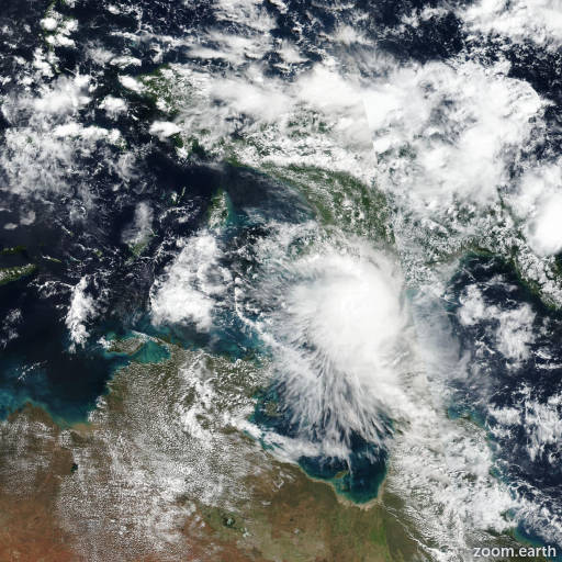
Cyclone 32P (33U)

Live tracking map, satellite images and forecasts of Tropical Cyclone 32P 2025 in the Arafura Sea. Current wind speed 55km/h. Max 65km/h.

32P (Tropical Low 33U) is located 885 km east-northeast of Darwin, Australia, and has tracked northward at 9 km/h (5 knots) over the past 6 hours. Minimum central pressure at 12/00:00 UTC is 1004 hPa. Maximum significant wave height is 3.7 meters (12 feet).

Satellite imagery shows 32P with a highly disorganized wind field. The low-level circulation has become stretched while the mid-level center remains displaced far to the east-southeast, near the flaring convection.

Analysis shows that 32P is in a marginally favorable environment characterized by strong poleward outflow, low (10–15 knots) wind shear, and warm (28–29°C) sea surface temperatures, offset by dry air entrainment. However, the environment is expected to quickly worsen as northerly shear increases to around 45 km/h (25 knots) in 12 hours, causing the vortex to further shallow.

32P is forecast to track off towards the west under the low-level easterly steering influence. Model guidance agrees on the westward track and no indication for redevelopment.

This is the final warning on this system by JTWC. The system will be closely monitored for signs of regeneration.