Severe Tropical Cyclone Maila 2026
Last Modified:
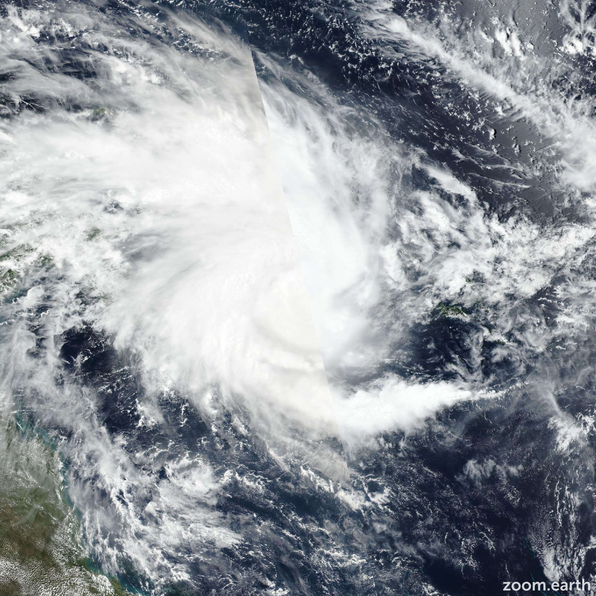
Live tracking map, satellite, radar, and forecasts of Severe Tropical Cyclone Maila 2026 near the Solomon Islands in the South Pacific Ocean. Current wind speed 165km/h. Max 185km/h.
Maila is located 1265 km northeast of Cairns, Australia, and has tracked eastward at 2 km/h (1 knot) over the past 6 hours. Maximum significant wave height is 8.5 meters (28 feet).
Maila is forecast to remain within a competing steering environment, sandwiched between ridging to both the north and south, over the next 2 days. During this time, the system is expected to continue moving at a very slow pace with potentially erratic directionality.
As it stands, a completion of the counterclockwise loop is forecast over the next 2 days. After 2 days, the ridging to the north will move northward, and the ridging over Australia will become the primary steering mechanism. This will allow for Maila to accelerate west-southwestward over the next 5 days.
There remains a considerable amount of uncertainty regarding how quickly the system will move out to the west and at what latitude. The JTWC track forecast calls for Maila skirting the tip of the papuan peninsula in 4 to 5 days, though that is subject to change.
In terms of intensity, Maila is forecast to continue intensifying over the next 12 hours as the environment remains favorable with low shear, warm sea surface temperatures, and strong poleward outflow.
After 12 hours, the upwelling of cooler waters will begin to impact the system due to the slow movement within the Solomon Sea. This will cause the intensification trend to halt.
In 36 hours, the cold pool will begin to deteriorate the vortex and weaken the system over the next 3 days. In 4 days, once the system has started to distance itself from the cold pool, Maila will attempt to recover and reintensify. However, if the system clips the papuan peninsula, the brief terrain interaction will hinder redevelopment.
Model guidance generally agrees on a track eastward over the next 36 hours followed by a slow turn to the west over the next 3 days. After 3 days, models diverge will varying track speeds.
There remains two main grouping of models with AI models and physics-based models. The physics based models show much quicker track speeds while the AI models are sluggish in the westward movement.
In 5 days, the Google DeepMind ensemble mean is just eat of the papuan peninsula while GFS is nearing the Cape York Peninsula. The JTWC track forecast is placed near the consensus over the next 3 days and then hedged between the Google DeepMind and ECMWF ensemble means over the next 5 days with low confidence.
Intensity guidance is split with HAFS-A and HWRF both suggesting gradual weakening from today onward. On the other hand, there are a handful of rapid intensification aids that continue to trigger over the next 24 hours.
After 24 hours, models agree on steady weakening over the next 5 days.
The JTWC intensity forecast is placed slightly close to the RI models over the next 24 hours and then near the multi-model consensus through the remainder of the forecast period with low confidence due to the uncertainties regarding the track.