Tropical Cyclone 20P 2021

Last Modified:
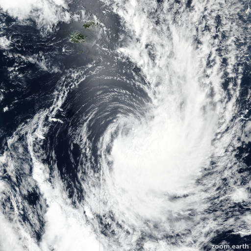
Satellite images, weather maps and tracks of Category 1 Tropical Cyclone 20P 2021, February 7 - 12. Max wind speed 85km/h.

20P is located 1243 km (671 nautical miles) south-southwest of Niue, and has tracked south-southeastward at 33 km/h (18 knots) over the past 6 hours.

Infrared satellite imagery shows moderate convection flaring to the south of the partially exposed low level circulation center (LLCC). Recent7z) ASCAT-C scatterometer data showed an elongated LLCC, with patches of 75 km/h winds (40 knots) to the east and south of the center, lending high confidence to both the initial position and initial intensity.

The system is rapidly moving towards the south-southeast along the tight gradient between a subtropical ridge to the east and a strong mid-latitude upper-level trough to the west.

20P is becoming increasingly extratropical as it moves over cool (<24°C) waters and moves under the influence of a strong shortwave trough, and embedded in the strong upper-level westerlies.

Analysis of the 1000-500 mb thickness data indicates weak, but increasing thermal advection, lending further support to the extratropical transition scenario.

The system is forecast to complete extratropical transition within twelve hours. Forecast models are in good agreement and there is high confidence in the JTWC forecast track.

This is the final warning on this system by JTWC. The system will be closely monitored for signs of regeneration.

Maximum significant wave height is 5.2 meters (17 feet).

Information provided by the Joint Typhoon Warning Center (JTWC).