Typhoon Kajiki 2025
Last Modified:
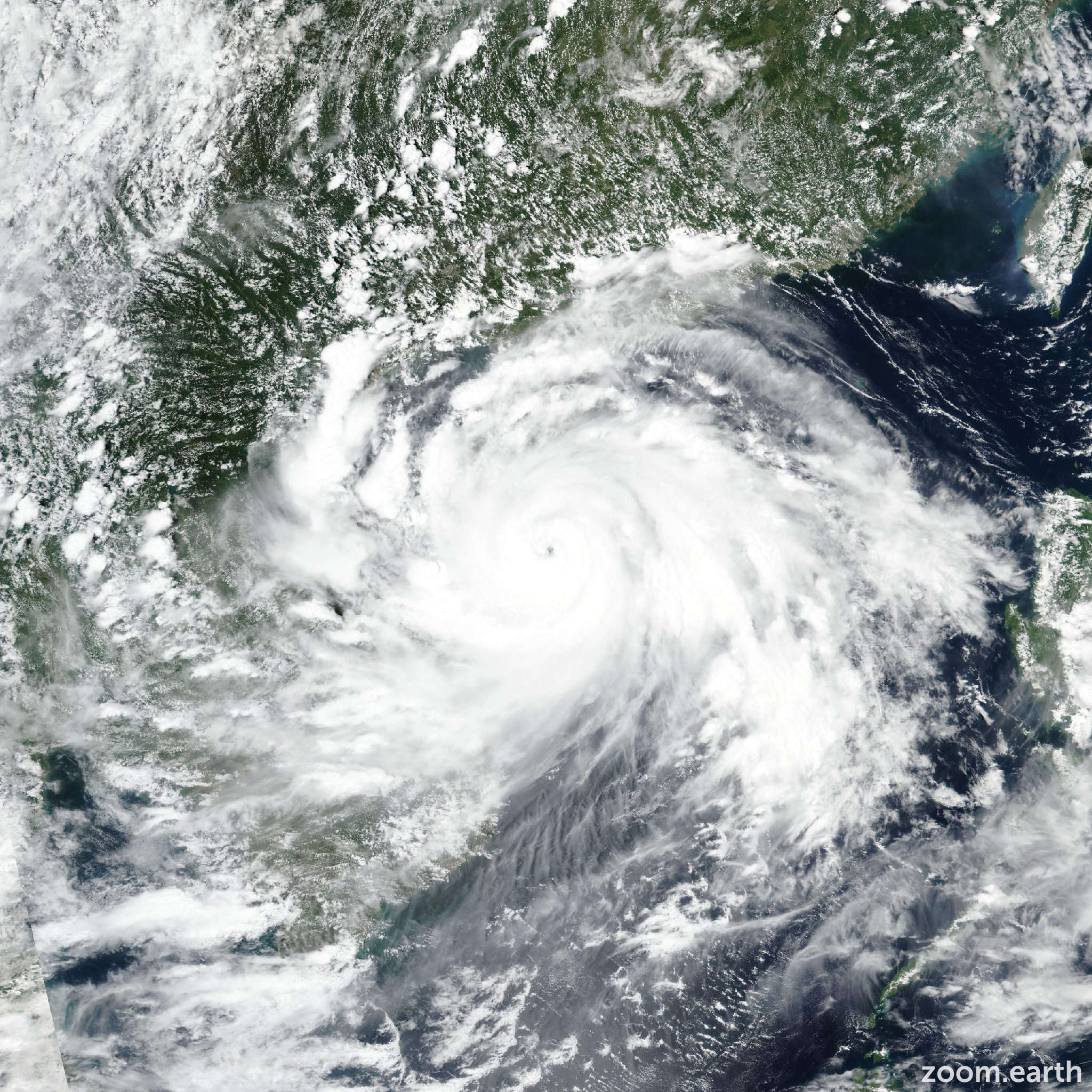
Live tracking map, satellite images and forecasts of Typhoon Kajiki 2025 (台風13号) near Hainan, China. Current wind speed 175km/h. Max 185km/h.
Kajiki (Philippine name Isang) is located 237 km north-northeast of Da Nang, Vietnam, and has tracked west-northwestward at 19 km/h (10 knots) over the past 6 hours. Maximum significant wave height is 11 meters (36 feet).
Kajiki is forecast to track west-northwestward through the forecast period, with landfall expected in around 18 hours.
The system is forecast to intensify to a peak of 185 km/h (100 knots) in 12 hours then weaken steadily as it approaches the coast of Vietnam. After landfall, the system will move into the mountainous region of northern Laos, with rapid weakening and dissipation in 2 days.
Deterministic guidance remains in tight agreement, with a 65 km cross-track spread at 24 hours. The 24/06:00 UTC GEFS and 24/00:00 UTC ECENS ensembles are also in good agreement, supporting the JTWC track forecast with high confidence.
Reliable intensity guidance (including COAMPS-TC (GFS) and HAFS-A) shows a peak intensity of 175–195 km/h (95–105 knots) at 12 hours, supported by triggered rapid intensification guidance.
After 12 hours, there is strong agreement that the system will rapidly weaken as it tracks toward the coast of Vietnam.