Tropical Cyclone 13S 2021

Last Modified:
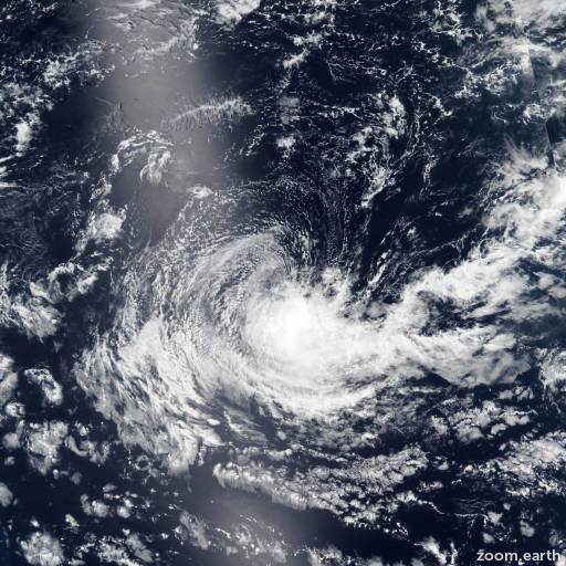
Satellite images, weather maps and tracks of Tropical Cyclone 13S 2021, January 20 - February 2. Max wind speed 65km/h.

13S, located approximately 925 southeast of Diego Garcia, has tracked westward at 24 km/h (13 knots) over the past 6 hours.

Satellite imagery shows a ragged and fully exposed low level circulation (LLC) with the associated weak, flaring convection sheared 130 nautical miles+ to the southeast.

The initial position is placed with high confidence based on the LLC in the satellite imagery loop that lined up well with the weak but discernible LLC feature in the SSMIS microwave image.

The initial intensity of 45 km/h (25 knots) is based on the SATCON ADT estimate of 45 km/h (25 knots) and is consistent with the degraded infrared imagery satellite convective signature.

Upper level analysis indicates the cyclone is under 25 knot+ of relative vertical wind shear as the storm motion has become 90° out-of-phase with the upper level wind flow.

Additionally, outflow is being suppressed by the shortwave trough to the southwest. 13S has fallen to below the JTWC warning intensity criteria of 65 km/h (35 knots) and is not expected to recover.

The remnants will propagate west-northwestward through a hostile environment. However, in 3 days, as it drifts into warmer sea surface temperatures (28°C), there is a possibility of regeneration.

This is the final warning on this system by JTWC. The system will be closely monitored for signs of regeneration.

Maximum significant wave height at 28/00:00 UTC is 10 feet (3 meters).

Information provided by the Joint Typhoon Warning Center (JTWC).