Tropical Storm Krosa 2025
Last Modified:
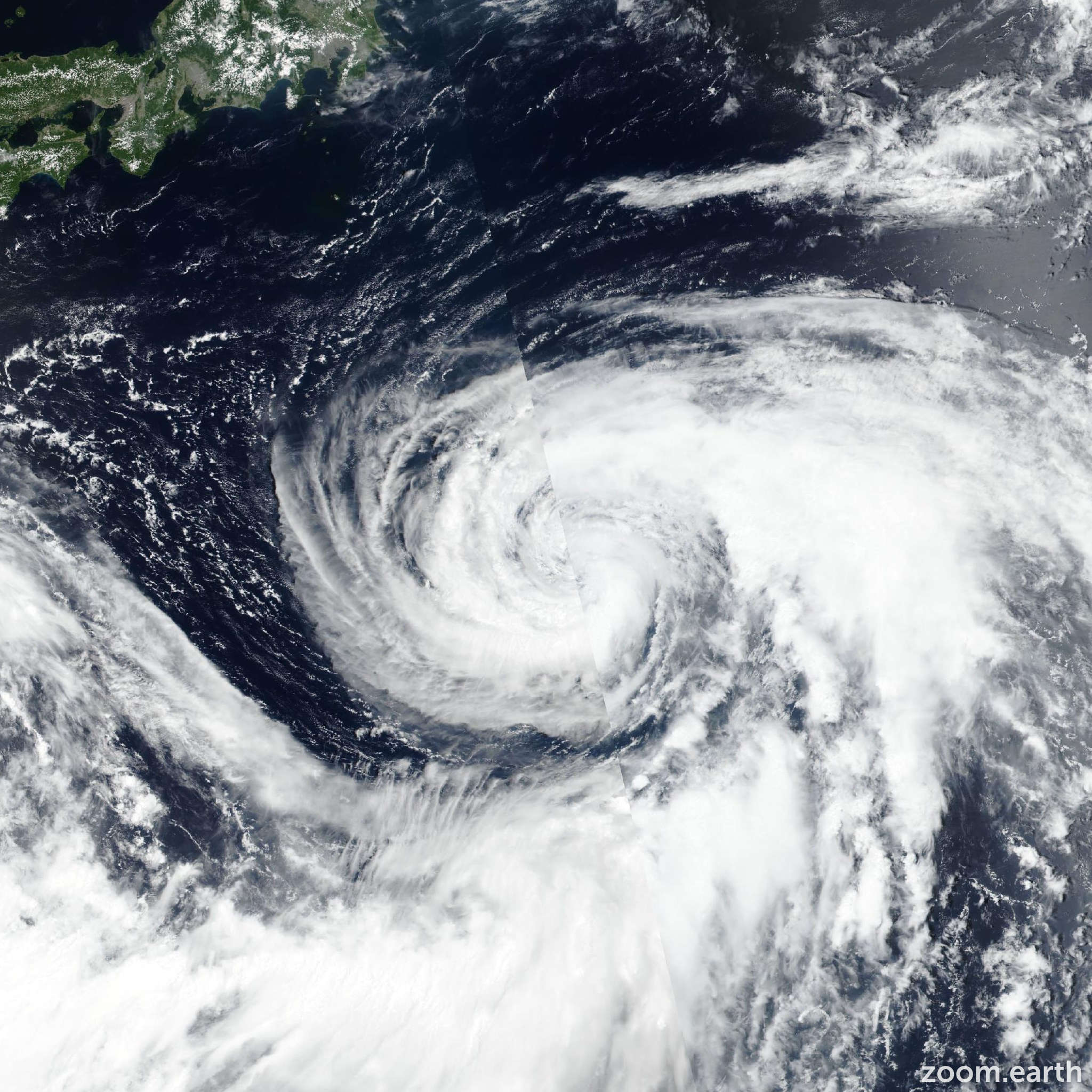
Live tracking map, satellite images and forecasts of Tropical Storm Krosa 2025 (台風9号) east of Honshu, Japan. Current wind speed 100km/h. Max 150km/h.
Krosa is located 213 km east-northeast of Narita Airport, and has tracked north-northeastward at 26 km/h (14 knots) over the past 6 hours. Maximum significant wave height is 7.9 meters (26 feet).
Krosa is forecast to continue moving east-northeastward under the influence of a deep-layer subtropical ridge centered to the southeast.
The system is currently in the vicinity of the Kuroshio Current, with majority of the windfield toward the poleward side. Therefore, the system is forecast to maintain intensity during the next 12 hours, utilizing the warm water influx.
Beyond 12 hours, environmental conditions will deteriorate with increasing wind shear, decreasing sea surface temperatures, and persistent dry air entrainment, leading to a gradual weakening trend.
In around 2 days, Krosa is expected to begin interaction with a baroclinic zone to the north and eventually merge with a deep-layer westerly flow, initiating extratropical transition.
Intensity is forecast to decrease to 55 km/h (30 knots) in 3 days as the extratropical transition completes by or before 3 days. Deterministic track model guidance shows good consensus through the forecast period, with a cross-track spread of less than 185 km at 3 days.
Along-track spread remains tight for the initial 2 days, with increasing uncertainty in forward speed thereafter. Intensity model guidance agrees on weakening past the next 12 hours, however, the GFS model still suggests slight intensification just before then.
Other models (COAMPS-TC, HAFS, and statistical-dynamical suite) forecast gradual weakening beginning immediately.
JTWC official intensity forecast is issued with medium confidence, placed on the higher end of the multi-model intensity envelope.