Tropical Depression 10P 2023

Last Modified:

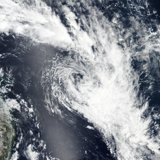
Satellite images, weather maps and tracks of Tropical Depression 10P 2023, January 17 - 21. Max wind speed 65km/h.

10P is located 378 km west of Noumea, New Caledonia, and has moved southeastward at 22 km/h (12 knots) over the past 6 hours.

Satellite imagery shows a fully exposed low-level circulation center (LLCC) with deep convection sheared off to the east. An ASCAT-B scatterometer image shows that 55-65 km/h winds (30-35 knots) persist to the south of the circulation.

As evidenced by the fully exposed appearance in multispectral imagery, copious amounts of dry air has infiltrated the circulation as well as increasing wind shear. These factors are quickly dominating the environment, which will result in a gradual weakening trend through the forecast period.

10P is forecast to continue tracking generally southeastward under the steering influence of a near-equatorial ridge to the north. In 12 hours, 10P will be preparing for a sharp poleward shift, as a ridge to the east builds in.

The system will dissipate in around 12 hours and begin a poleward track, continuing to weaken in 24 hours and beyond. Forecast models are in good agreement that 10P will maintain course over the next 12 hours after which the system turns poleward.

Reliable model intensity guidance is also in good agreement, with all members weakening the system through the forecast period.

This is the final warning on this system by JTWC. The system will be closely monitored for signs of regeneration.

Maximum significant wave height is 4.9 meters (16 feet).

Information provided by the Joint Typhoon Warning Center (JTWC).