Tropical Storm Jerry 2025
Last Modified:
Live tracking map, satellite images and forecasts of Tropical Storm Jerry 2025 east of the Leeward Islands. Current wind speed 65mph. Max 80mph.
Tropical storm conditions are expected in the warning area and are possible in the watch area this evening through Friday morning.
Heavy rainfall will impact portions of the Leeward Islands, British Virgin Islands, U.S. Virgin Islands, and Puerto Rico through Friday, which could result in flash flooding, particularly in urban areas and in steep terrain.
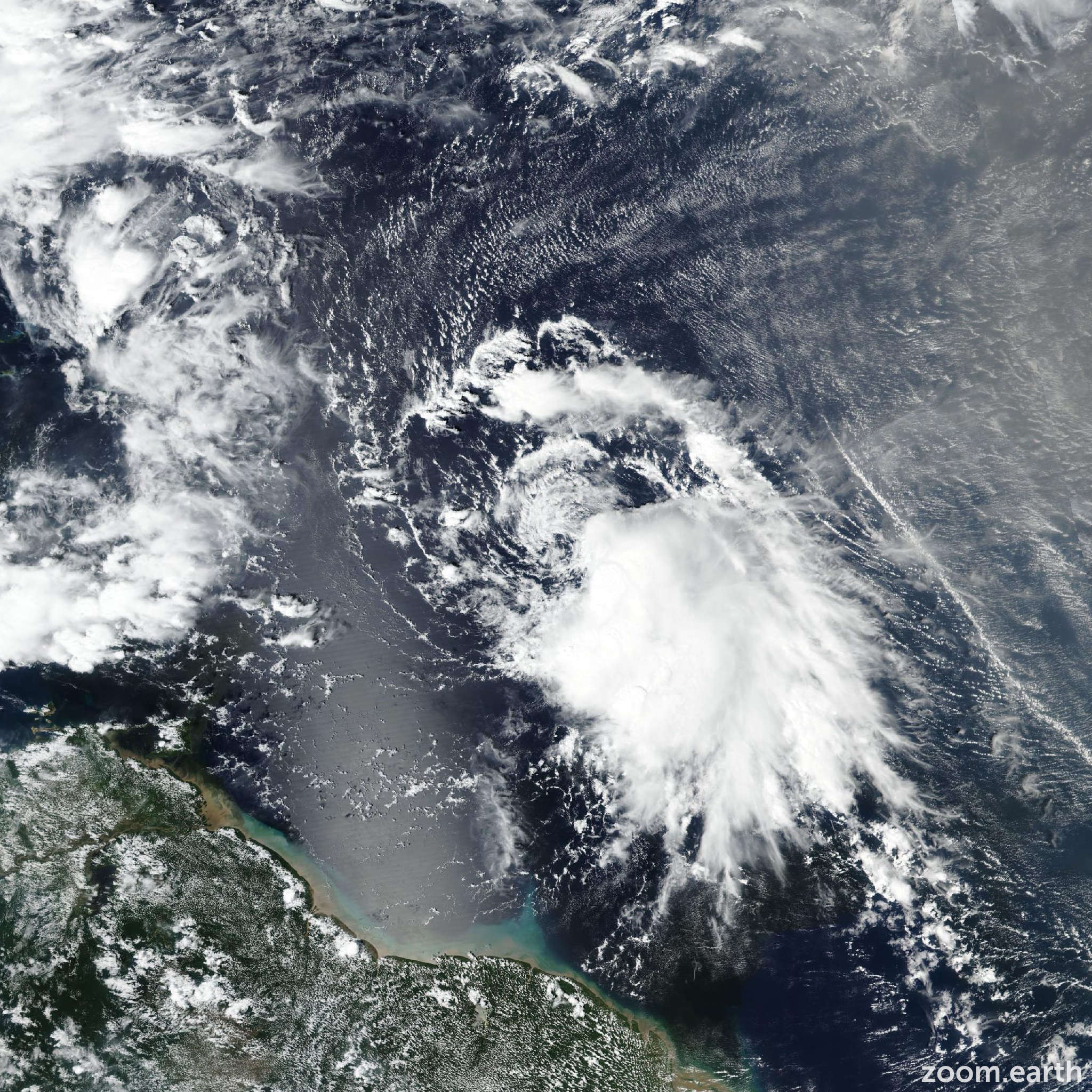
Satellite images, aircraft observations, and ASCAT data indicate that Jerry is a poorly organized and strongly sheared tropical storm. The low-level center is now fully exposed and elongated, with the main area of deep convection located on the system's south and southeast sides. The initial intensity is again held at 65 mph (55 knots), but that could be a little generous. The center of Jerry is less than 100 miles from the northern Leeward Islands, which is often close enough to experience strong winds. However, the ASCAT and aircraft data showed that the strongest winds are confined to a region east of the center. In fact, winds are quite light on the west side.
Jerry has been moving erratically today (9 October), but smoothing through the fixes suggest that the storm is gradually turning to the right. The initial motion is now estimated to be 300/16 knots. This general motion should continue through early Friday, taking the center of the system near or over the northern Leeward Islands during that time. However, as mentioned above, the strongest winds should pass to the east of the islands due to Jerry's asymmetric structure. A turn to the north is expected to occur by late tomorrow, and that motion should continue through most of the weekend as the storm moves in the flow on the western side of a subtropical ridge. Early next week, a faster eastward or east-northeastward motion is forecast in the mid-latitude westerlies. Jerry is expected to pass east of Bermuda in a few days, and given its expected eastward asymmetry, significant impacts appear unlikely there. No significant changes were made to the previous track forecast, and this prediction is in best agreement with the HCCA and Google DeepMind ensemble mean.
Strengthening in the short term seems unlikely given Jerry's poor initial structure. However, after the storm passes the northern Leeward Islands, the vertical wind shear could decrease some while Jerry remains over warm water and in a moist air mass. Therefore, slow strengthening is predicted from late Friday through Sunday. The opportunity for strengthening will likely end early next week when the system moves into stronger shear and over cooler waters. The NHC intensity forecast has been nudged downward due to a combination of the storm's poor initial structure and latest guidance.