Tropical Storm 09W 2026
Last Modified:
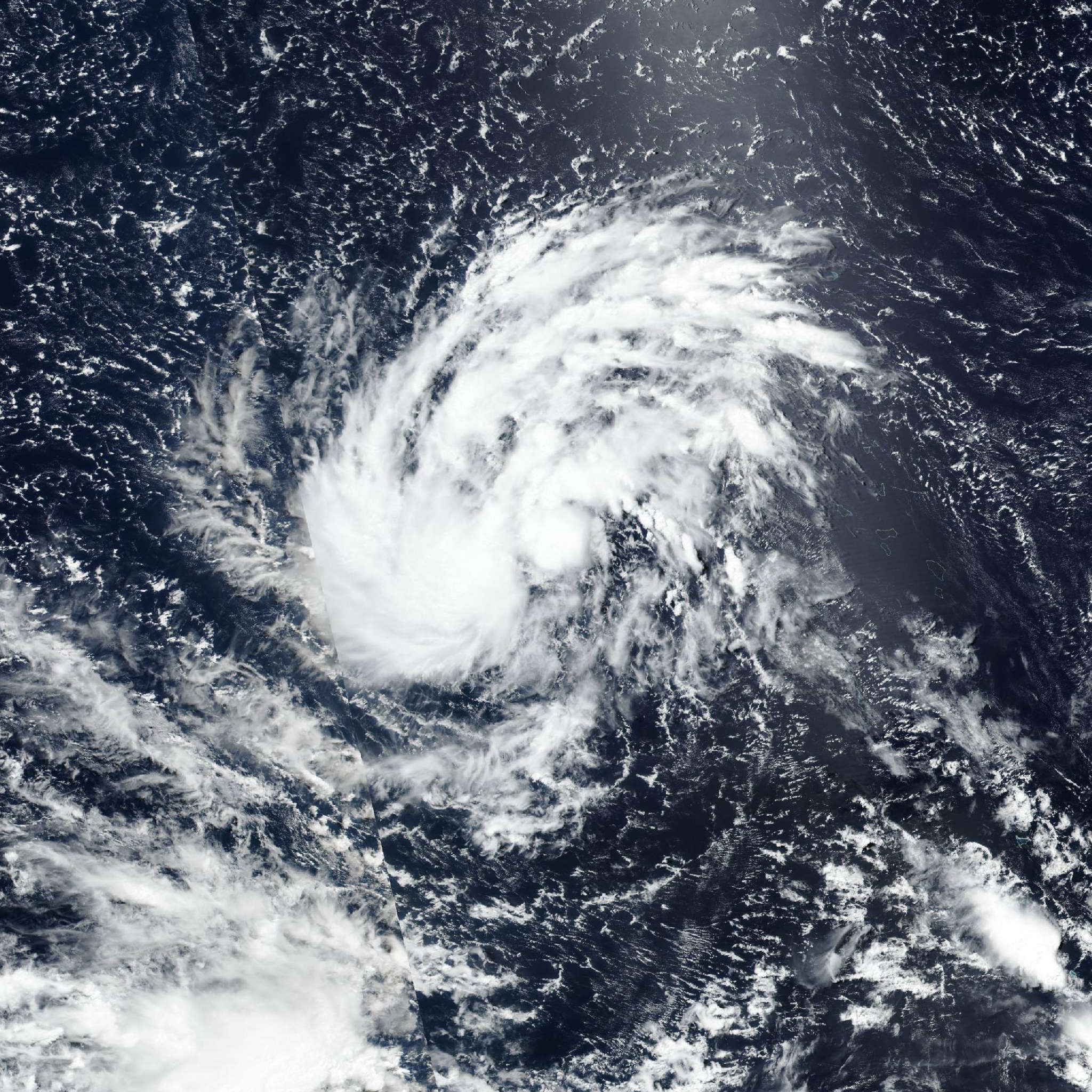
Live tracking map, satellite, radar, and forecasts of Tropical Storm 09W 2026 in the western Pacific Ocean. Current wind speed 65km/h. Max 230km/h.
09W is located 1902 km east-southeast of Tinian, and has tracked northwestward at 17 km/h (9 knots) over the past 6 hours. Maximum significant wave height is 4.6 meters (15 feet).
09W will continue tracking generally northwestward for the next 12 to 24 hours as it remains steered by the subtropical ridge centered to its northeast.
In around 24 hours, a separate subtropical ridge centered to the northwest will build and extend eastward, gaining steering influence over 09W in the process.
After 09W transitions steering ridges, it will move generally west-northwestward through the remainder of the forecast period. In 48 to 60 hours, the eastward extension of the steering ridge is expected to weaken, causing a slight slowdown in 09W’s translational speed and a slight dip in 09W’s track.
The ridge is expected to reorient shortly thereafter and keep 09W on its west-northwestward trajectory over the next 5 days. Regarding intensity, 09W is currently forecast to steadily intensify until the next 24 hours while it continues to consolidate.
The system is expected to rapidly intensity over the next 24 hours until the next 60 hours. Following the next 60 hours, 09W is forecast to continue intensifying at a slightly slower rate until remaining steady in 4 to 5 days.
In the late-term forecast, 09W is expected to encounter a dry air mass to the west and north of the system; however, by this time, 09W is expected to be a mature typhoon and should be able to cocoon itself off from the surrounding dry air, as indicated by forecast models. Additionally, forecast models show 09W will have an expansive wind field, and is expected to introduce destructive winds across CNMI and Guam as it passes south of Tinian.
Deterministic model track guidance is in good agreement through the duration of the forecast, with the exception of GFS, which shows a track significantly farther north, and UKMET, which shows a track south of Rota.
Experimental AI models are in good agreement with the other physics-based members of the JTWC consensus, with a tight clustering of reliable models passing between Rota and Tinian.
The JTWC track forecast is placed in concurrence with the bulk of consensus members and experimental AI models with high confidence over the next 3 days.
The chief concern in the late-term forecast is the location of the vortex center as 09W passes through the islands. As a result, the JTWC track forecast is placed with medium confidence in 3 to 5 days.
Reliable intensity aids are in good agreement in a rapid intensification trend in 24 to 60 hours. The spread in peak intensity currently sits at a 45 km/h (25 knots) spread at 5 days—with COAMPS-TC (GFS boundary conditions) and GFS deterministic on the lower side and HAFS-A on the high side. As a result, the JTWC intensity forecast is assessed with medium confidence over the next 3 days and low confidence in 3 to 5 days, with uncertainty in the late-term forecast stemming from the uncertainty surrounding the peak intensity as 09W undergoes RI.