Tropical Storm 07W 2026
Last Modified:
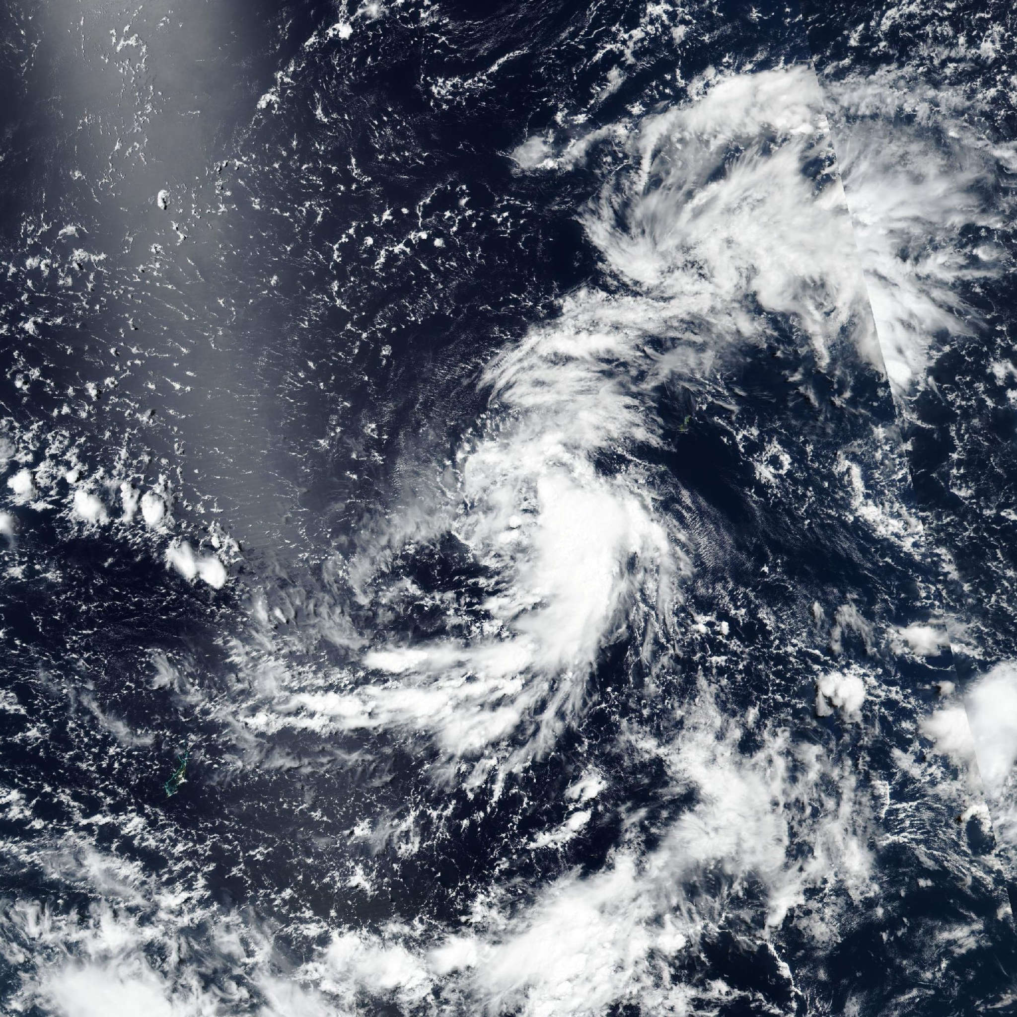
Live tracking map, satellite, radar, and forecasts of Tropical Storm 07W 2026 in the Philippine Sea. Current wind speed 65km/h. Max 220km/h.
07W (Philippine name Francisco) is located 507 km west of Andersen Air Force Base, and has tracked west-northwestward at 30 km/h (16 knots) over the past 6 hours. Maximum significant wave height is 4.9 meters (16 feet).
07W is forecast to track west-northwestward, along the southwestern edge of the subtropical ridge, over the next 3 days.
After 3 days, 07W is expected to begin a poleward turn as it rounds the western extent of the subtropical ridge. However, simultaneously to the poleward turn, a separate subtropical ridge is expected to build over the northern South China Sea. This will create a competing steering environment and will cause 07W to slow down considerably as it tracks southeast of Taiwan over the next 5 days.
Regarding intensity, 07W is forecast to steadily intensify over the next 24 hours as the vortex becomes more symmetric and vertically aligned.
After 24 hours, a more rapid rate of intensification is expected as shear remains low and sea surface temperatures remain very warm. Rapid intensification (RI) is explicitly forecast to occur in 24 hours to 3 days (55 knots to 120 knots).
The peak intensity is forecast to occur in around 3 days as northeasterly shear greatly increases afterward. Additionally, the slow movement speed near the end of the forecast period may allow for the upwelling of cooler waters. As a result, a weakening trend is expected to occur after 3 days as the system commences its poleward turn.
Model guidance is in good agreement over the next 3 days with the exception of GALWEM and UKMET, which track the system straight westward over the next 36 hours rather than west-northwestward.
Disregarding the two outliers, there is a cross-track spread of 352 km at 3 days. After 3 days, models generally agree on the poleward turn, but fan out to a cross-track spread of 565 km at 5 days.
The GEFS ensemble mean continues to make up the easternmost model while the EC-AIFS now makes up the westernmost. The JTWC track forecast is placed close to the modified consensus (removing GALWEM and UKMET) over the next 3 days and then slightly to the west of the consensus over the next 5 days with overall medium confidence.
Nearly all available intensity guidance agrees on a rapid or near-rapid rate of intensification over the next 3 days with a multitude of RI aids triggering this model run.
HWRF and HAFS-A show a peak intensity of 215 km/h (115 knots) and 240 km/h (130 knots) respectively at 3 days. The JTWC intensity forecast is placed near the HAFS-A, which is slightly below the bulk of the RI aids, throughout the forecast period.
Confidence in the intensity forecast is placed with low confidence due to the inherent uncertainties regarding RI.