Cyclonic Storm 07A 2022

Last Modified:
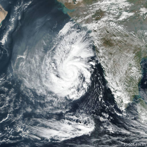
Satellite images, weather maps and tracks of Cyclonic Storm 07A 2022, December 12 - 17. Max wind speed 85km/h.

07A is located 969 km southeast of Masirah Island, and has moved westward at 11 km/h (6 knots) over the past 6 hours.

Satellite imagery shows a fully exposed low-level circulation center (LLCC), with disorganized, flaring convection displaced about 148 km to the east due to persistent southwesterly wind shear, currently estimated at 35 km/h (20 knots).

The initial position is assessed with high confidence based on the exposed LLCC in the visible imagery. The persistent and increasing southwesterly shear and low to mid-level dry air encroachment have taken their toll on 07A, and have led to a complete decoupling of the lower and upper-level vortex.

Without a stacked vortex, the system is not long for this world. While the intensity is currently assessed at 65 km/h (35 knots), this is likely a bit generous, and in any case the unfavorable conditions expected going forward mean that it will slowly spin down below the 35 knot warning threshold within the next 12 hours.

While anticipated to be a 30 knot system in 12 hours, it is likely that the remnant circulation will linger for some time, and hence the final warning includes a the next 24 hours position, where it is anticipated the system will still be a 30 knot circulation. Thereafter the system will dissipate slowly as it drifts generally westward.

This is the final warning on this system by JTWC. The system will be closely monitored for signs of regeneration.

Maximum significant wave height is 3.7 meters (12 feet).

Information provided by the Joint Typhoon Warning Center (JTWC).