Hurricane Flossie 2025
Last Modified:
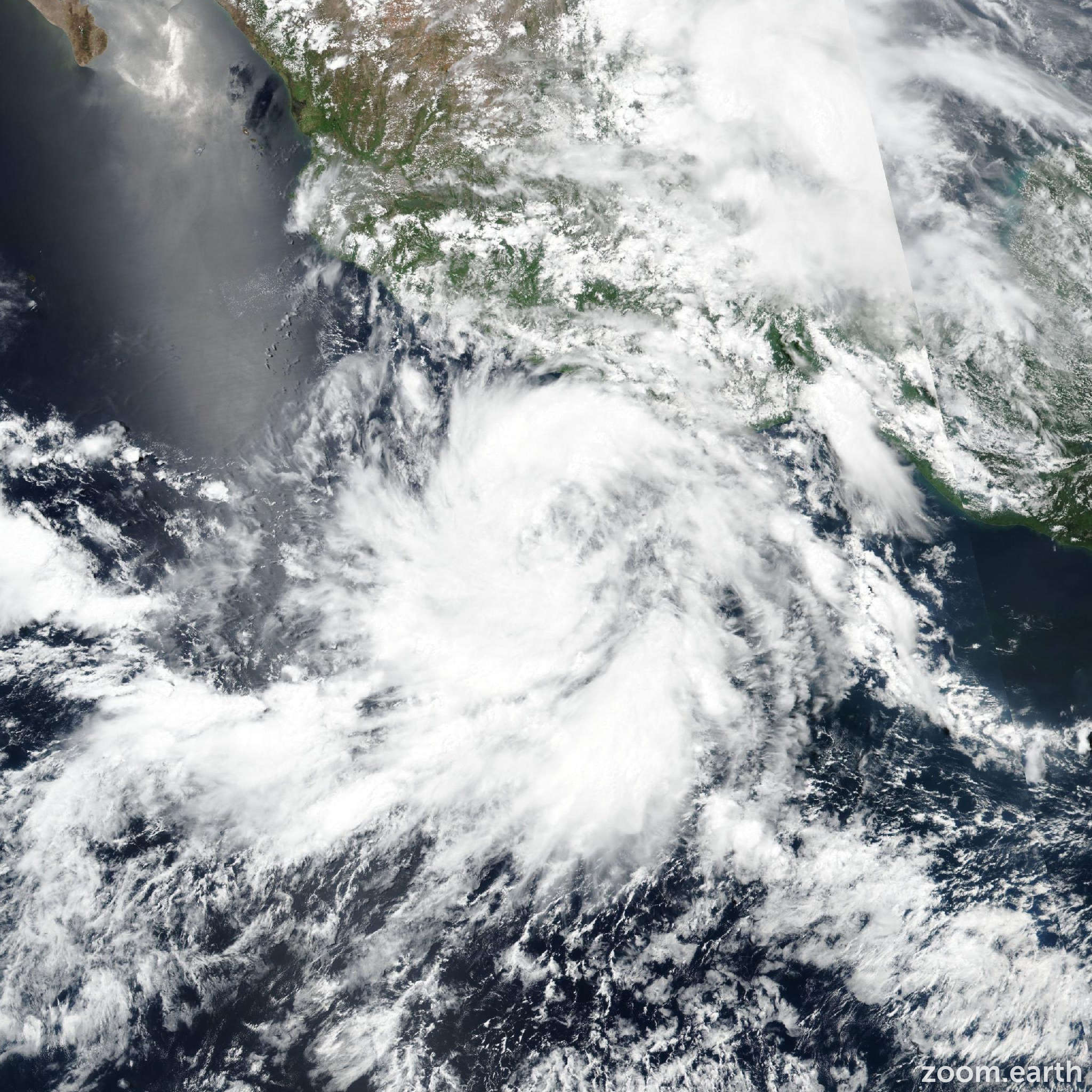
Live tracking map, satellite images and forecasts of Hurricane Flossie 2025 near Jalisco, Mexico. Current wind speed 75mph. Max 110mph.
The outer bands of Hurricane Flossie should bring locally heavy rainfall to coastal portions of the Mexican states of Guerrero, Michoacán, Colima, and Jalisco through Wednesday. Life-threatening flooding and mudslides are possible, particularly in steep terrain.
Tropical storm conditions are expected in portions of the tropical storm warning area in southwestern Mexico, tonight through Tuesday.
The satellite presentation of Flossie has continued to improve this evening, with a hint of an eye now possibly developing in the past hour or so. The latest subjective Dvorak intensity estimates came in at T4.0/65 knots and T3.5/55 knots from SAB and TAFB respectively. The objective intensity estimates range from 56 to 70 mph (62 knots) at 00z and have since increased to between 62 and 85 mph (74 knots). Based on these data and the improved satellite appearance, the initial intensity has been raised to 75 mph (65 knots) for this advisory package, making Flossie a hurricane.
Flossie is heading toward the west-northwest or 300/09 knots. This motion with a gradual decrease in forward speed is expected during the next several days as the cyclone is steered into a weakness in the mid-level ridge to the northwest. The track forecast is very close to the previous advisory and is closely aligned with a blend of the latest HCCA, TVCE and FSSE consensus aids.
The environment will remain very conducive for strengthening during the next 36 hours, with warm sea surface temperatures of 28/29°C, abundant mid-level moisture, and light vertical wind shear. In fact, the latest SHIPS RI probabilities show a greater than 60% chance of a 25-knot increase in 24 hours, and the official forecast reflects this. Additional strengthening is forecast through 36 hours, with the cyclone beginning to weaken by 48 hours as it moves over cooler water. Rather rapid weakening will then follow as Flossie moves over progressively cooler water and begins to entrain dry mid-level air. The system is forecast to become a post-tropical low by 72 hours and a post-tropical remnant low at 96 hours. The intensity forecast is on the high end of the intensity aids, closest to SHIPS and NNIC, which show rapid intensification.