Tropical Storm Erin 2025
Last Modified:

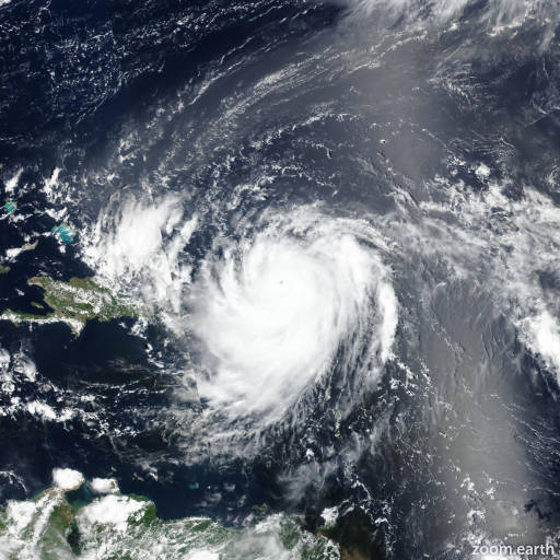
Live tracking map, satellite images and forecasts of Tropical Storm Erin 2025 in the central Atlantic Ocean. Current wind speed 60mph. Max 125mph.
Locally heavy rainfall, high surf and rip currents, and tropical-storm force winds could occur in portions of the northern Leeward Islands, the Virgin Islands, and Puerto Rico this weekend as the core of Erin passes north of those islands. Interests in these areas should continue to monitor the progress of Erin.
While there is still uncertainty in what impacts might occur in portions of the Bahamas, the east coast of the United States, and Bermuda next week, the risk of dangerous surf and rip currents across the western Atlantic basin next week is increasing. As we approach the climatological peak of the hurricane season, this is an opportune time to ensure your preparedness plans are in place.
Satellite imagery shows that Erin has become a little better organized this morning (14 August), with the formation of a ragged central dense overcast with some outer banding in the northwestern semicircle. Satellite intensity estimates have increased a little during the past 6 hours and are now in the 40–55 knots range. Based on these data, the initial intensity is increased to 60 mph (50 knots).
Erin will be in an environment of light-to-moderate easterly vertical shear and moving over increasing sea surface temperatures during the next 48 hours. This should allow a faster rate of intensification during this time, and Erin is now forecast to become a hurricane by 24 hours. The environment becomes less conducive after 48 hours, with the global models forecast northwesterly shear over the cyclone as a large upper-level anticyclone develops to the west. Despite this forecast shear, the global and regional hurricane models forecast intensification to continue, although at a slower rate than during the first 48 hours. Based on these forecasts, the new intensity forecast shows steady intensification through 48 hours, followed by a slower rate of development during the remainder of the forecast period. The new forecast is near the intensity consensus, and there is guidance that suggests the possibility Erin could be stronger than currently forecast.
The initial motion is now 275/15. The storm continues to be steered by a subtropical ridge to the north, and this ridge should steer the cyclone generally west-northwestward during the next three days. After that time, the western portion of the ridge is forecast to weaken or break due to the influence of the mid-latitude westerlies over the northeastern United States. This evolution should lead to Erin turning toward the northwest or north-northwest during the remainder of the forecast period, although there is significant spread in the guidance on just how sharp this turn will be. The new forecast track is south of the consensus models through 48 hours and then lies near the consensus models thereafter. Due to the spread in the track guidance by 120 hours and beyond, there is still a greater than normal uncertainty about what impacts Erin may bring to portions of the Bahamas, the east coast of the United States, and Bermuda in the long range.