Tropical Storm Dalila 2025
Last Modified:
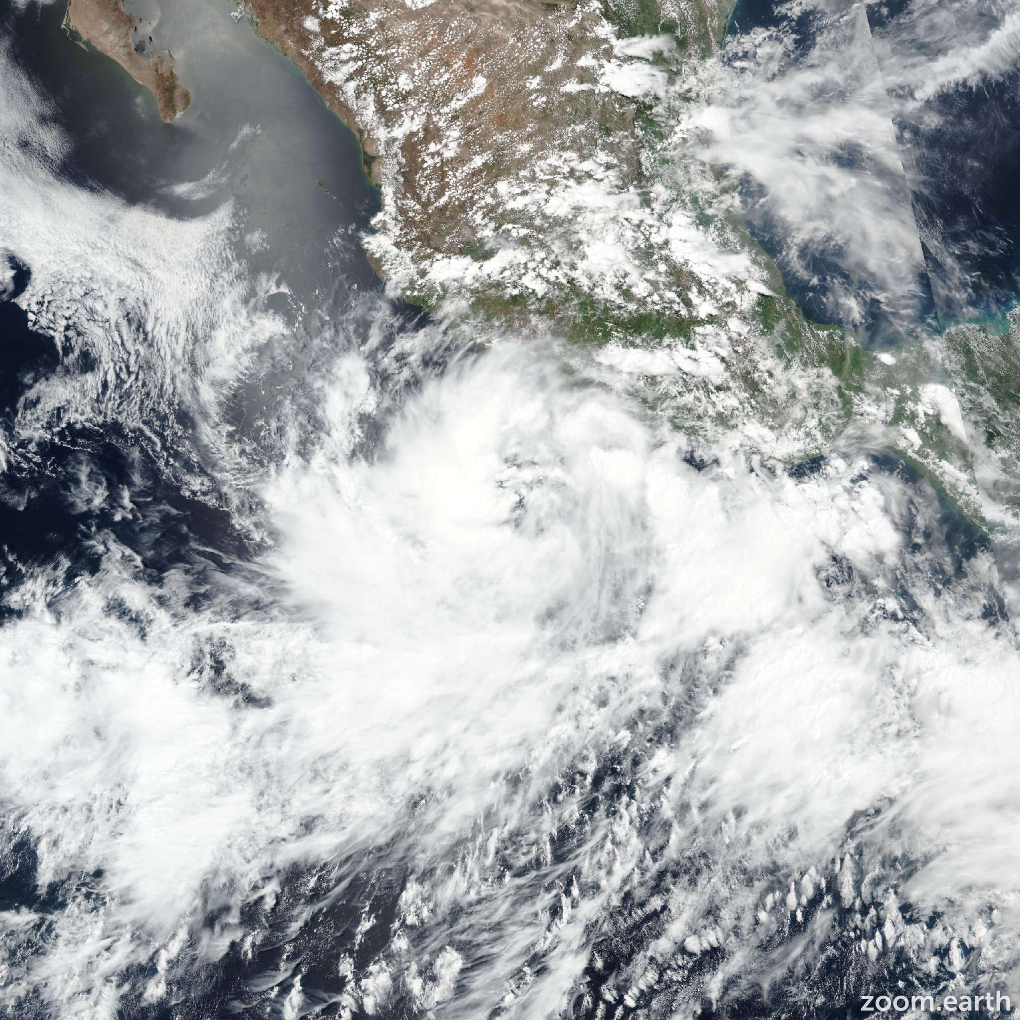
Live tracking map, satellite images and forecasts of Tropical Storm Dalila 2025 near Jalisco, Mexico. Current wind speed 50mph. Max 65mph.
The outer bands of Tropical Storm Dalila will bring locally heavy rainfall to the Mexican states of Guerrero, Michoacán, and Colima through Sunday morning. Scattered areas of flooding and mudslides are expected, especially in areas of steep terrain near the coast.
Dalila is expected to produce tropical-storm-force winds across portions of the warning area tonight and Saturday.
Dalila has become better organized early this morning (14 June), with the latest satellite images showing well defined convective banding around the low-level center. The latest subjective Dvorak intensity estimates from TAFB and SAB were T3.5/55 knots and T3.0/45 knots. Objective estimates ranged from 34 to 50 mph (43 knots), while a recent ASCAT pass showed several wind barbs close to 45 mph (40 knots). Based on a blend of these data and taking into account the potential for some under-sampling in ASCAT, the initial intensity for this advisory has been increased to 50 mph (45 knots).
Dalila is heading toward the northwest, or 305/10 knots. A turn toward the west-northwest is expected later today (14 June) as the system moves along the southern periphery of a building mid-level ridge over northern Mexico and the southwest U.S. A gradual turn toward the west is expected tonight and Sunday, as Dalila moves over cooler water and becomes increasingly steered by the low-level trade wind flow. A westward motion is then forecast to continue through dissipation Monday night, and this may be generous as Dalila may not survive that long. The track forecast lies nearly on top of the previous track and is in close agreement with the latest consensus guidance.
There is a limited window for Dalila to strengthen as it will remain over warm water and light to moderate effective easterly shear today. The forecast calls for some strengthening today, and the peak intensity was nudged slightly higher to better align with the latest intensity model trends. Beginning tonight the system will cross the 26°C isotherm and over progressively cooler water, and this is expected to begin the weakening phase with Dalila forecast to become a post-tropical remnant low Sunday night, and possibly sooner than that. The latest intensity forecast close to the middle of the intensity guidance envelope through the forecast period.