Cyclonic Storm 04B 2026
Last Modified:
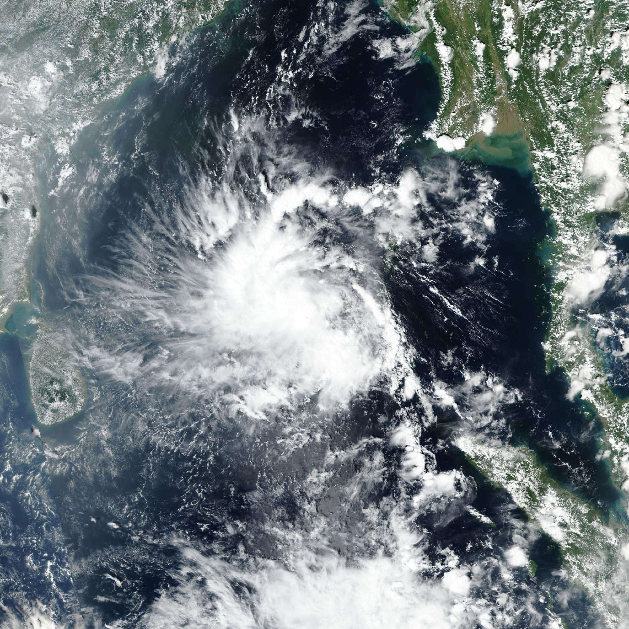
Live tracking map, satellite, radar, and forecasts of Cyclonic Storm 04B 2026 in the Bay of Bengal. Current wind speed 65km/h. Max 95km/h.
04B is located 1237 km south of Kolkata, India, and has tracked west-northwestward at 19 km/h (10 knots) over the past 6 hours. Maximum significant wave height is 4 meters (13 feet).
04B is forecast to track northwestward for the entirety of the forecast period under the influence of a subtropical ridge centered to the northeast.
Track speed will slow as it approaches eastern India, with landfall expected to occur in 36 to 48 hours. Track speed will slow as the system interacts with the terrain.
Regarding intensity, 04B is expected to intensify out to a peak of 95 km/h (50 knots) in 24 to 36 hours as environmental conditions remain favorable and the system continues to consolidate. After this point, it is expected to sharply weaken once it makes landfall and terrain interaction deteriorates the vortex.
Track model guidance is in good agreement throughout the forecast period, with a 157 km cross-track spread at the time of landfall.
After landfall, the majority of models slow in track speed and show a slight westward turn. The official JTWC forecast track is assessed with high confidence, in good agreement with both the multi-model and AI consensus.
Intensity model guidance is quite spread, with COAMPS-TC, HWRF, and Decay-SHIPS depicting peaks of 100–120 km/h (55–65 knots) at 36 hours while GFS shows only 75 km/h (40 knots) at this time.
The Decay-SHIPS models are the slowest to show dissipation at 3 days, with the majority of models dissipating 04B in 60 hours. The forecast is thus extended out over the next 3 days to allow for the possible slower dissipation as Decay-SHIPS is skilled in landfall forecasts, although due to its higher peak, the official JTWC shows dissipation before 3 days.
A rapid intensification (RI) aid has also populated, though not depicted in the forecast. Models are in good agreement on the sharp weakening and dissipation following landfall but retain a 35 km/h (20 knots) spread due to the different forecast peaks.
The official JTWC intensity forecast is thus assessed with low confidence, in good agreement with the multi-model consensus.