Tropical Cyclone 03S 2020-2021
Last Modified:
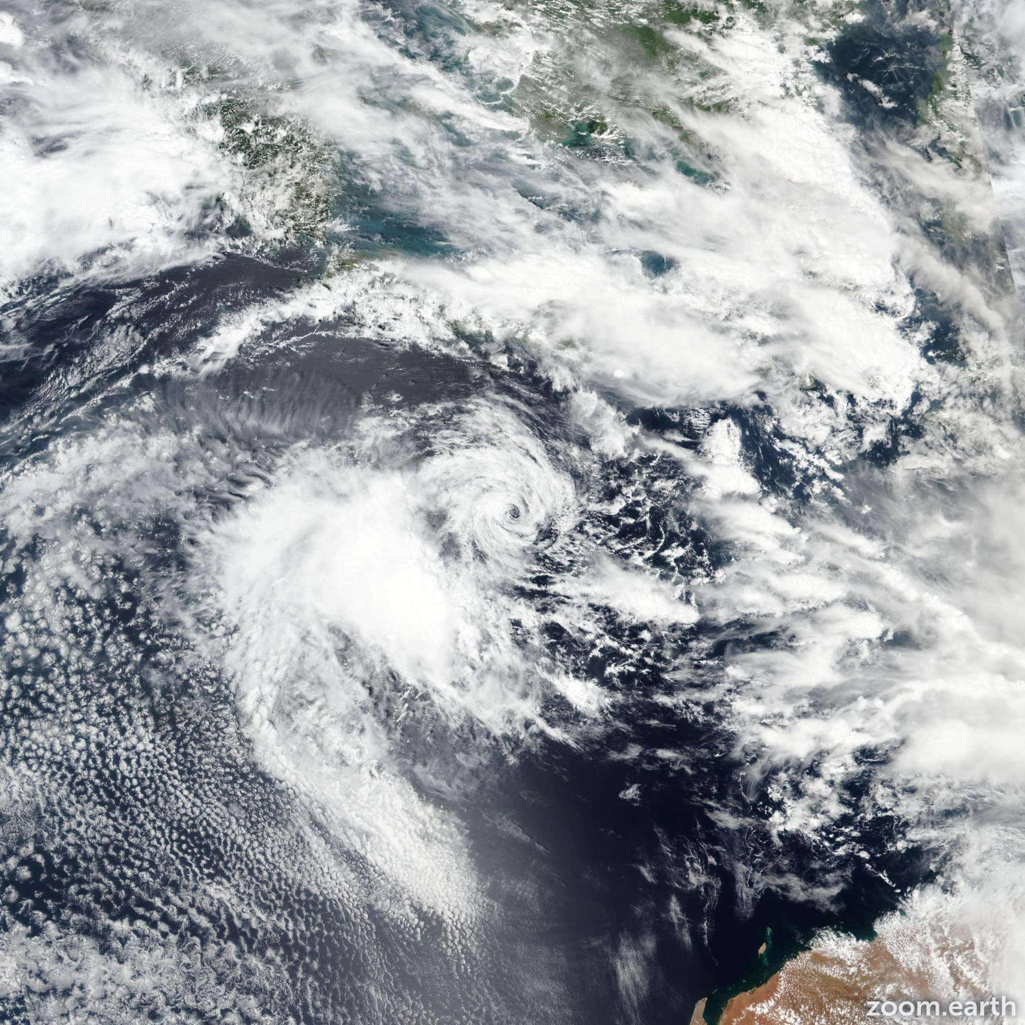
Satellite images, weather maps and tracks of Category 1 Tropical Cyclone 03S 2020-2021, December 5 - 12. Max wind speed 85km/h.
03S, located approximately 53 nautical miles south-southeast of Port Hedland, Australia, has tracked southeastward at 24 knots (45 km/h) over the past 6 hours.
Infrared satellite imagery indicates that 03S made landfall at 11/03:00 UTC, approximately 34 nautical miles west of Port Hedland, and has slowly weakened and tracked inland over the past few hours.
Maximum surface winds (10-minute average) at Port Hedland were 38 knots (70 km/h) gusting to 49 knots (90 km/h) with minimum SLP near 994mb. Radar imagery now shows convective banding wrapping into a broad low-level circulation center, which supports the initial intensity assessment of 35 knots (65 km/h) and initial position with fair confidence. 03S is forecast to quickly track southeastward under the combined steering influence of a deep trough to the southwest and a subtropical ridge to the northeast. 03S will weaken gradually and should dissipate in 12 hours well inland.
Numerical model guidance is in tight agreement lending high confidence to the JTWC forecast track. This is the final warning on this system by JTWC.
The system will be closely monitored for signs of regeneration.
Information provided by the Joint Typhoon Warning Center (JTWC).